Skiing the Bairs Creek Cirque
Adventures in Soul-Crushing on California's Second-Highest Fourteener
Mount Williamson, California — Darkness. I have been climbing in darkness for hours on this massive, merciless mountain, and my will is crumbling.
I have climbed thousands of vertical feet already, a cumulative attack that has finally bested me. I've reached the crux of my climb right here, right now, in the middle of the night, body exhausted, mind defeated, surrounded by towering spires of black that rise against the stars...
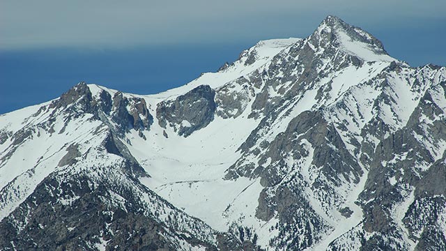
True story: for the past year, whenever I have felt weak, or sick, or banged my toe on a corner, gotten stuck in traffic, or just been lowered by the usual existential angst, I have quelled my misery with a simple mantra—this is good training for Williamson.
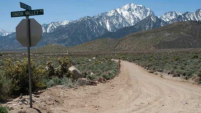
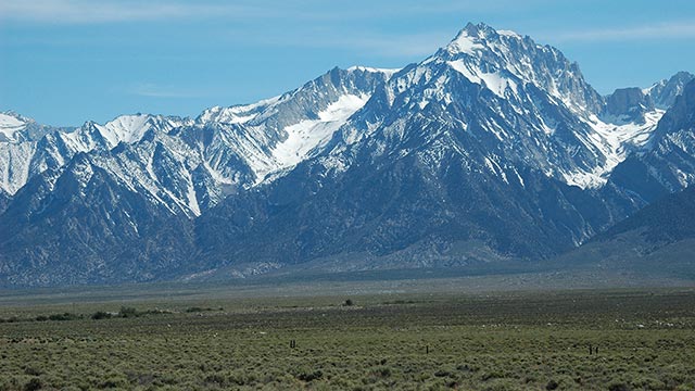
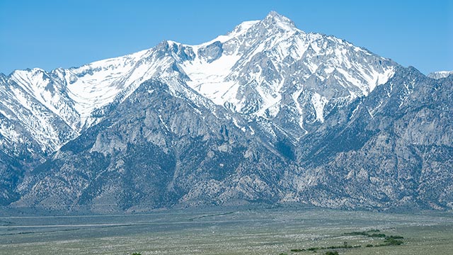
If you have ever driven California's Highway 395 through Owens Valley, you know Mount Williamson. Among the many impressive peaks towering some 10,000 vertical feet over Owens Valley, Williamson is easily identifiable: it is the big mountain.
At 14,375 feet above sea level, Williamson is California's second highest peak, behind Mount Whitney. But, as Climbing California's Fourteeners authors Stephen Porcella and Cameron Burns put it, "In overall dimensions, Mount Williamson has no rival."
Williamson dominates the landscape in a way perhaps unmatched by any other peak in the range, offering an unmistakable invitation—a call, should you hear it, that cannot be refused.
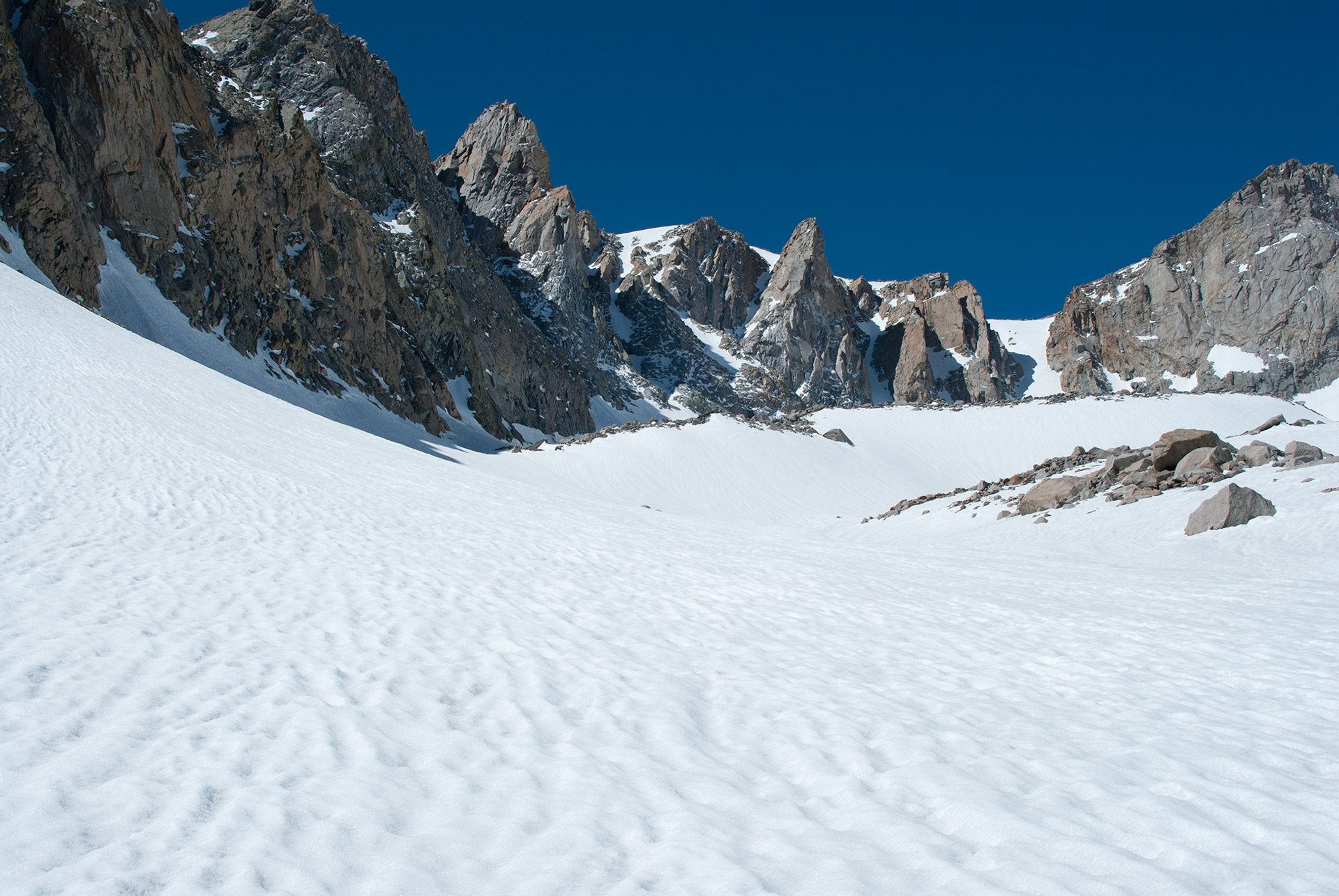
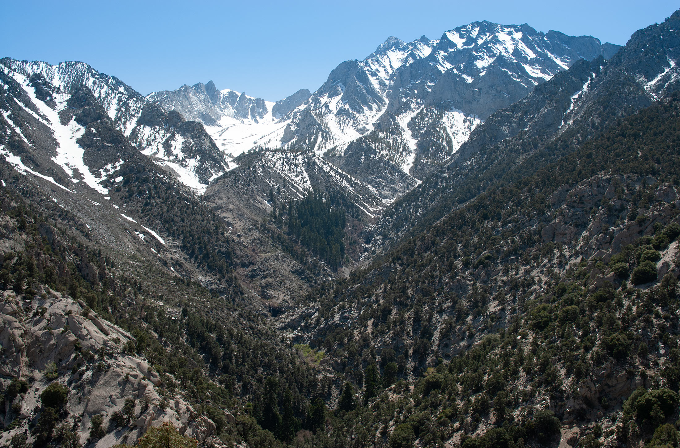
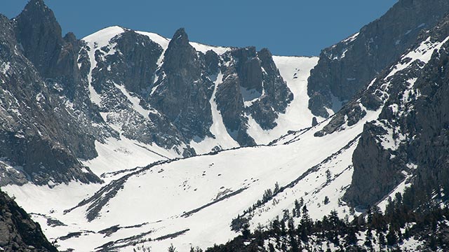
The North Fork of Williamson's Bairs Creek drainage ends in a spectacular amphitheater carved out long ago by glaciers. Seen from Highway 395 just south of Independence, the cirque's gleaming snowfields are surely as tempting a skier's treat as anything to be found in the entire Eastern Sierra.
Via Bairs Creek, it is possible to ski from the true summit of Mount Williamson, down the headwall, through the cirque, and all the way down (in good conditions) to 7000' or so, deep within the claustrophobic lower reaches of the drainage. But backcountry travelers beware: Williamson stands ready to crush any would-be suitors with an approach savage enough to turn back even the most hardened mountaineer.
I first attempted to ski the Bairs Creek Cirque in May 2005. After hours battling talus, thorns, and scrub I turned back, having barely reached the snow. The unexpected difficulty of the approach made me wonder if success was even possible. Returning to Mount Williamson would require a number of adjustments. Physical preparation, technique, gear, strategy—everything would have to change if I was to have any chance of success.
But I did learn something critical while flailing about on Williamson's flanks: there was no rational way to justify the suffering involved. Returning would not be about enjoying a spectacular ski descent (even if such was the case). No, I would need a new reason to motivate me, to keep me moving upward with skis on my back when every shred of reason screamed otherwise.
Hence my unusual strategy of the past year, turning life's trials into training. I would have to patch together a crazy quilt of determination, stoicism, optimism, denial, and—yes—even raw arrogance. In the end, I could only hope it would be enough to get me to the summit and back.
5906
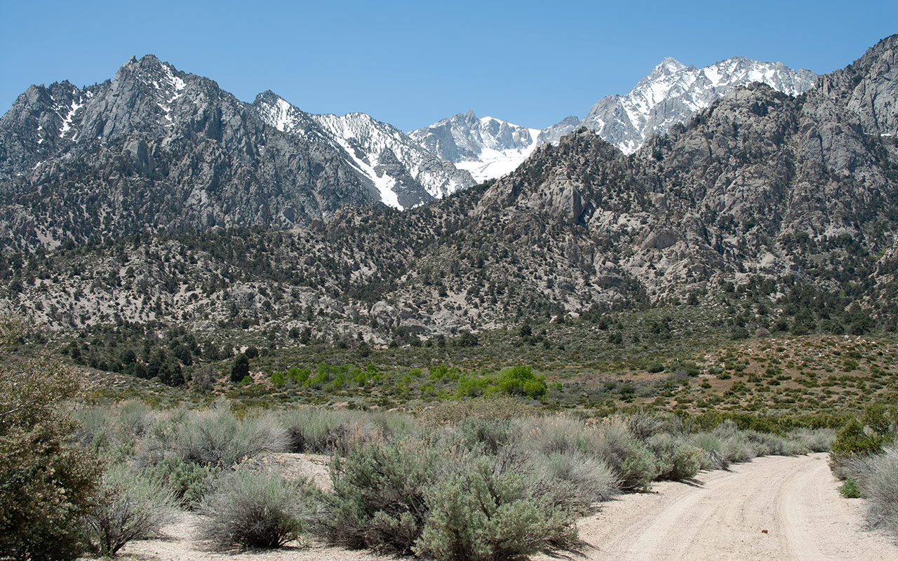
Climbing Williamson is as pure as it gets. Park at the bottom of the mountain. Hike up. With a trail, via Shepherd Pass, most backcountry travelers will find the most strenuous climb of their lives.
Without a trail, as is the case of the George Creek and Bairs Creek approaches, the climb becomes something else entirely, a transcendent experience that would perhaps best serve its clients, in the end, if it directed them through the gates of an insane asylum.
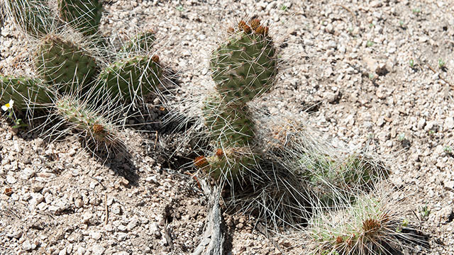
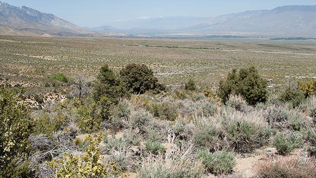
According to my National Geographic Topo! software, Foothill Road crosses the north fork of Bairs Creek at an elevation of 5906'.
This is where you park your car and begin hiking.
At 5906 feet, the Owens Valley is hot, dry desert, and the mere thought of putting skis on your back and tromping around in the dust is absurd.
I had tried without success to recruit a partner for this endeavor. But now, as I stared upward and contemplated the challenges that lay ahead, I decided I was better off solo.
Misery loves company, to be sure, and it would seem that bringing a partner could only make success on Williamson more likely.
But choose your would-be companion wisely. If you are unlucky enough to bring along a man or woman with even a semblance of sanity, they will almost certainly turn back far, far, from the summit, swearing never to return.
In this way, your own aspirations would be thwarted.
If, however, you remain determined to share Williamson's trials, you are thus put in the unfortunate position of having to bring along a person as crazy as you are—and this is always a dangerous proposition.
As I began hiking up the loose sandy ridgeline, already panting in the dry desert air, I realized I was beginning to get a sense of the purpose that had thus far eluded me. This was a test. I was doing this hike to see if I could do it.
And what clearer result could there be than to do it solo, where success or failure would be entirely my own doing?
Looking for the Notch
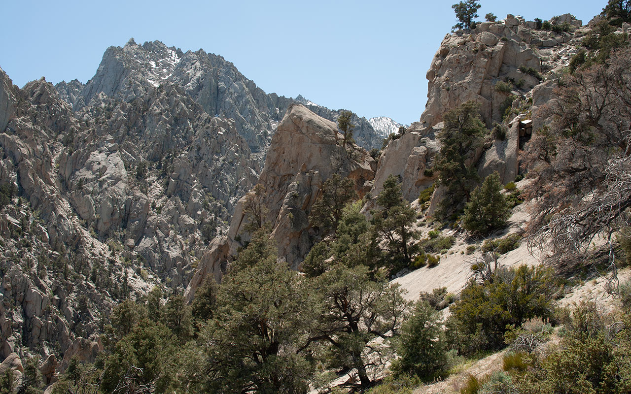
Despite the heat and the dust, this initial phase of the approach is actually one of the easier parts of the climb. The principal challenge is finding a hidden notch along the ridgeline north of Bairs Creek.
Barring use of a helicopter, there are essentially three bad options in gaining entry to the Bairs Creek drainage: traversing the ridge along the south side of the creek, climbing up the creek itself, or traversing the north ridge.
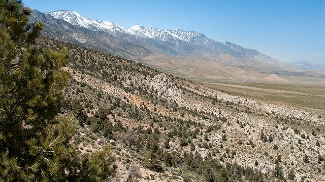

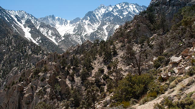
Each option is complicated by the presence of cliffs and vegetation. The south option seems to feature the most cliffs, while the creek obviously offers the most brush and willows.
That leaves Option Three, the north ridge, as potentially the best of the bunch. The idea in this case is to traverse high above the creek and cliffs, finding (eventually) a hidden notch that permits access back down into the upper drainage.
In 50 Backcountry Ski Summits, Paul Richins calls this notch 'obvious.'
My experience suggests there are many prominent notches in the area, none of which is the right one.
The best strategy is probably to go by elevation. Around 7200', leave the right side of the ridgeline and start traversing left across steep, seemingly-cliffed terrain.
If you're lucky, you'll stumble upon a faint game trail heading toward the correct notch, which makes travel across the steep slope somewhat easier.
You'll enjoy occasional glimpses of Williamson's twin horns, high above, as well as the enticing upper snowfields of the Bairs Creek Cirque.
To the east, the panorama of the Sierra, the Owens Valley, the White Mountains, and the Inyo Mountains gradually unfolds.
As I hiked up, searching for the Notch, I felt strong.
My unconventional strategy of reframing suffering as training seemed to have me well prepared for anything Williamson could throw at me. I was sweating out a lot of water in the Owens Valley heat, which was a concern, but I kept drinking from my Nalgene bottle, trying to stay hydrated.
One foot in front of the other.
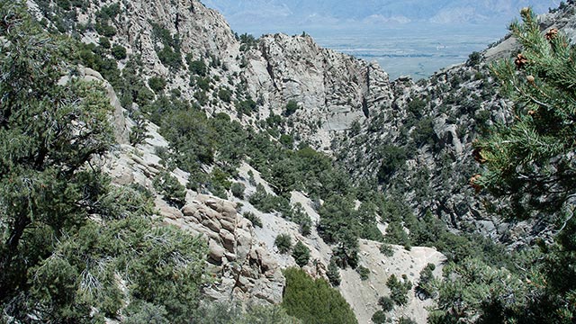
Once the traverse to the Notch begins, stumbling and falling is a constant threat. The ground is loose, sandy scree and talus, made more challenging by a fully-loaded pack. This is not a trivial traverse; I actually have to cover quite a lot of ground, wrapping around the mountainside, to get within sight of the true Notch.
An unexpected benefit of the north option is that it affords solid views of Bairs Creek, some 400-500 vertical feet below, and the south side of the drainage. One good look at either should be enough to convince you you've made the right choice as far as route selection goes.
Normally, I am the first to decry the forest service whenever it fails to provide me with a decent approach trail. But here on Williamson's lower flank, I find myself oddly ambivalent. A trail would certainly make things much easier, though by no means easy. And yet, part of me relishes the challenge. I want to experience the full magnitude of this adventure, without any help or mitigating factors.
This is no longer about skiing—how could it be? I am in my prime here. Someday, my bones will grow brittle and my mind will wither. But not today. I am a righteous man, invincible, ready to ride the back of the dragon to the land where the sun never rises.*
*obscure quote from TV series Kung Fu
The Hero's Traverse
Confronting despair is one of the great challenges of Williamson. The mountain can induce a crippling sense of hopelessness, and over the past year's 'training,' I have repeatedly warned myself to be ready for it.
Success will seem impossible. The mountain will grow higher, farther, steeper. I have told myself these things, and yet, when I reach the Notch and stare into the rugged Bairs Creek drainage below, I am nonetheless paralyzed by the view.
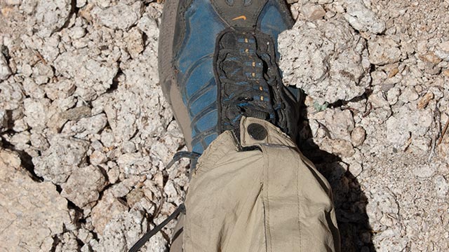
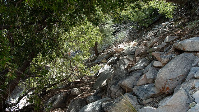
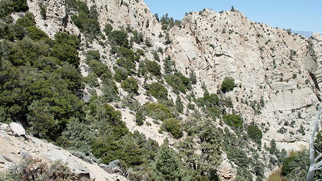
The Cirque is maddeningly distant. The summit isn't even visible. Just to get to the creek, I've got to traverse perhaps two miles of steep, trailless scree blocked by cliffs and low-hanging trees.
If I get to the creek, the Cirque—and the snow—are another 2000 vertical feet above.
One of the nagging questions this past year has been whether the Williamson Approach was really as bad as my memory insisted.
Now, as I begin the slow, painful traverse to the creek, I realize my memory has indeed failed me. The reality of the climb is much, much worse.
Slipping, sliding, stumbling, I start across the north side of the drainage.
From the Notch there is a semblance of a trail, which quickly breaks apart as the brush thickens.
Whether these faint paths were made by carefree scampering animals, or humans staggering beneath 50lb backpacks and skis, I cannot say, but I will note the paths travel repeatedly underneath overhanging branches.
The branches inevitably catch my ski tips, threatening to tip me over. I resort to crouching, bending over, and hiking backwards to try to pass through these obstacles.
When that is not possible, I'm forced to ditch the pitiful trail and hike up or down the cascading rock and scree.
Theoretically, it might be possible to maintain an even traverse to the creek and thus avoid excessive climbing and descending. In reality, however, the traverse soon winds around gullies and cliff bluffs, which force me to climb up and down, and even backtrack.
It is utterly withering. Recalling my attempt a year ago, I find myself impressed I got as far as I did. The Traverse goes on. The heat is positively baking me. I'm carrying two liters of water, and I'm already running low. I'm reconsidering my earlier thoughts on not wanting a trail.
My mind begins to wander, seeking escape. I christen this part of the route "the Hero's Traverse," for it requires a heroic effort to press onward, rather than simply collapse into the sandy earth. I keep going.
Ode to Williamson
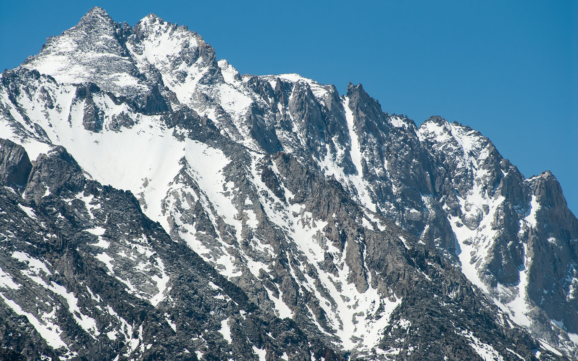
Mount Williamson's north face & Giant's Steps Couloir
Oh Cruel Williamson
Oh Cruel Cruel Williamson
Oh Cruel, Cruel, Cruel, Williamson
No One Will Ever Understand
No One Will Ever Understand
No One Will Ever Understand
Heartbreak Ridge
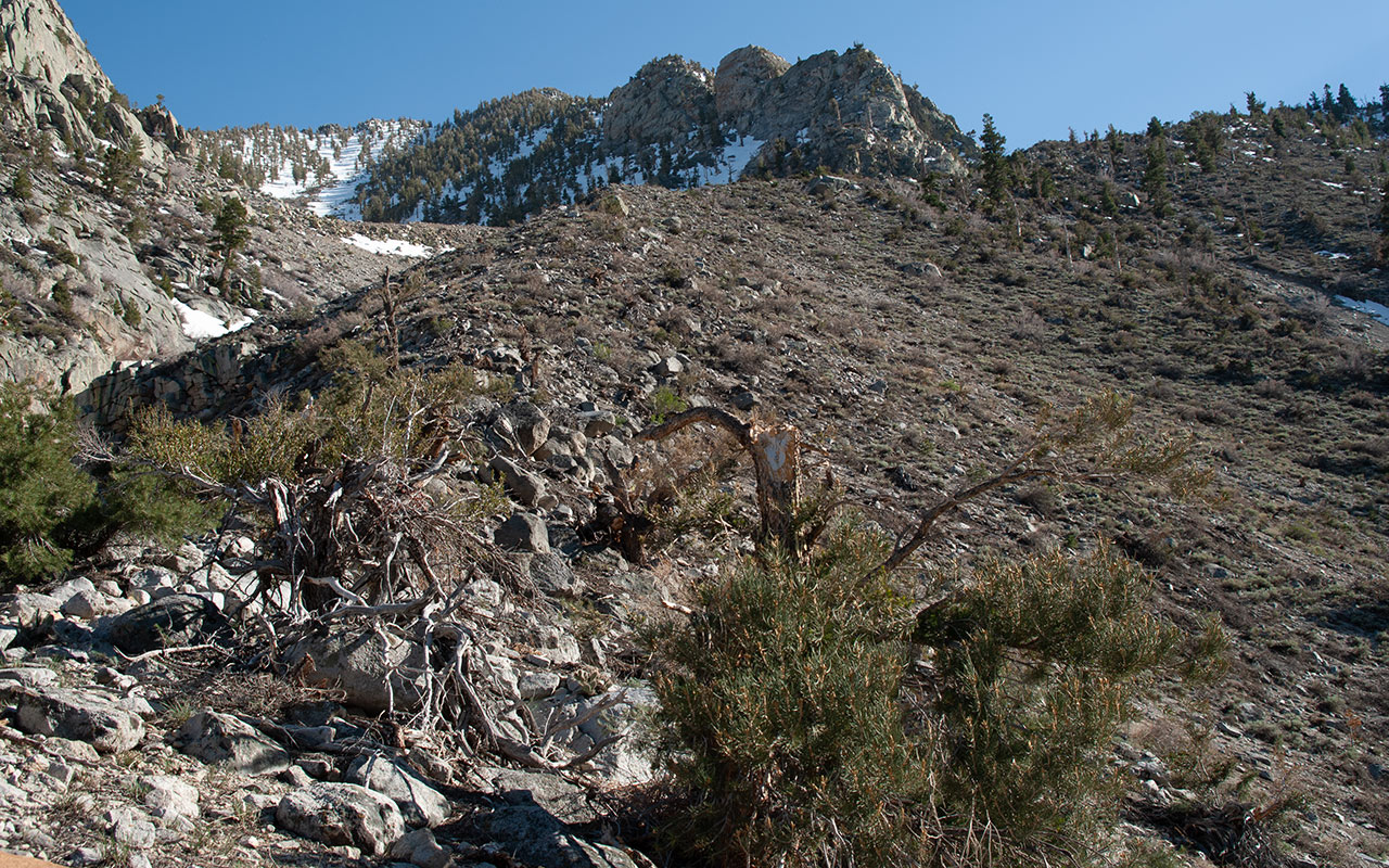
The Long Climb to the Cirque
The Traverse concludes when I finally decide to abandon the north side of the drainage and cross the creek, perhaps a few hundred yards past a landmark I recognize from last year: a hump-like bench of dirt where someone long ago flattened out a camp site.
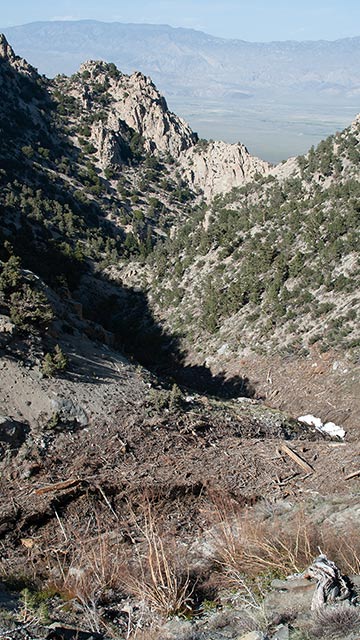
I am now deep within the narrow confines of the drainage, which is choked with avalanche debris, some fresh, some old. In the cool shadows beside the creek, I stop and eat a quick snack. The rigors of the Traverse have taken their toll. I am exhausted.

I had hoped to ski this route in early March, when there might actually be snow at this elevation.
The Sierra Winter, however, altered my plans. Lingering instabilities deep within a record-setting snowpack convinced me to wait for the safer, consolidated snowpack of spring.
Consequently, instead of switching to skis and skins, I must instead climb up 2000 vertical feet of steep, loosely-piled talus and debris to reach the Cirque.
Thankfully, the piles of avy debris make the creek crossing only mildly difficult.
Once across, I round the corner and get a shock:
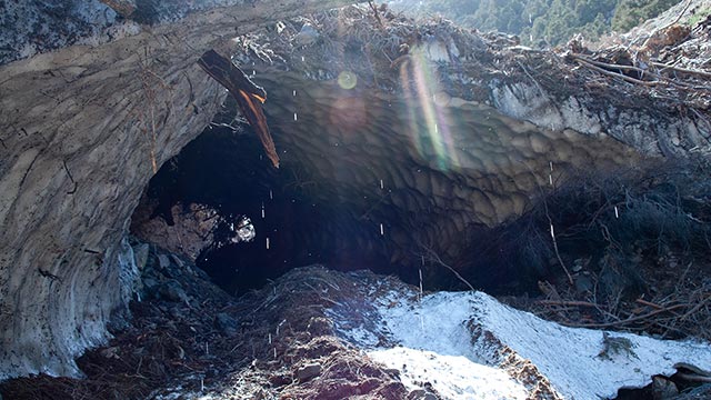
I see a massive snow bridge, which the creek has tunneled through, producing a cave some 20 feet high and 100 feet long.
This is the product, I believe, of not this year's but last year's avalanche season, when an enormous slide piled snow and debris across the drainage.
During my ski attempt a year ago, I'd seen the aftermath of that slide, which was of a scale so large I hadn't immediately recognized it as an avalanche. This unusual, massive feature deserves a closer look, so, despite my fatigue, I carefully make my way along the creek to the base of it.
Cool air blows from the mouth of the snow cave, while cascading drops of water glitter in the sun. I see buried within the snow the stripped-bare remains of mature trees. Incredibly, the cave goes all the way through. I can see sunlight at the far end of it.
The place has a dark, ominous feel, and I am happy to leave it behind and resume my climb.
The route from here ought to be straightforward. The creek forks, with the left branch leading up a steep ravine that eventually opens into the Bairs Creek Cirque.
The ravine, however, has several chokes that cliff out in waterfalls. Moreover, cliffs rise along either side.
I need to get to the western edge of the ravine, which I know from last year's adventure I can follow all the way up to the Cirque.
But how to get there?
I enjoy the company of yet another section of willow, crossing between two waterfalls, which permit me access to the west side of the ridge. After a short climb over steep debris mixed with rock, I reach the ridge, where I'm rewarded with a fine overview of my route thus traveled.
Owens Valley now appears far below, beginning to glow in the late afternoon sun. I can also retrace my path back to the Notch, via the 'Heroic Traverse'.
I reach my campsite from last year. Surprisingly, there is no snow. Last year, later in May, I was able to begin skiing at this point.
It's five p.m. I've been hiking a little more than four hours straight, with at least 1500 vertical feet of trailless talus to go to reach the Cirque. My reserves and my morale are low.
If I can make it to the snow, I tell myself, I can ski this mountain.
The ridge has that unique quality where it seems to go on forever. Just as I think I've crested the worst of it, I see I still have much, much more to climb. This area of the route is noteworthy for the extraordinary avalanche evidence I observe. The ridge appears to have been regularly blasted by powerful avalanches which have scoured away everything in sight.
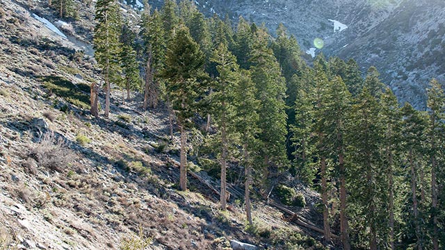
Given the winding, angled terrain, it's hard to identify where, exactly, the slide(s) originated. It seems possible that the ridge I'm standing on gets hit from multiple directions, making a midwinter ascent much less palatable of an option. The avalanches are not without a sense of whimsy, however. To my right is a triangular grove of trees I dub "the World's Luckiest Forest."
This stand of mature evergreens has somehow escaped the ravages of the surrounding avalanches, which have blasted everything away on all sides of it. Clearly, given the force of the avalanches, topography alone has spared the grove. What a place this would be to camp in winter, and witness the unimaginable destruction all around.
Meanwhile, Heartbreak Ridge, as I've now named it, goes on. If I can make it to the snow, I can ski this mountain. I repeat the phrase over and over, like the Little Train that Could, trying to motivate myself to keep climbing. This portion of the climb is pure gruel, heart pounding, lungs gasping, legs grinding out steps on aching muscles over loose, constantly shifting soil.
If I can make it...
More than once, despite my best efforts, a loose rock gives way, and I am driven to the ground beneath the weight of my pack. Normally, I take considerable pride in never falling. Here, there is nothing to do but suffer the indignity, right myself, and resume the climb.
...make it to the snow...
I am heartened to see the vertical walls of the Cirque beginning to close above me, and I get a mental lift as I pass my turnaround point from last year: a last waterfall close-out just beneath the Cirque that closed the case on my summit bid. With more snow, the waterfall might be passable to the east, or even vanish entirely. Currently, however, the only safe route is the west side of the ravine, and I'm thankful to be there.
...I can ski this mountain...
Just another few hundred vertical feet, and I will finally be able to see into the Grand Cirque itself. As much as I'm anticipating the moment, I'm even more motivated by the thought of dropping my heavy pack and setting up camp for the night.
Sage Camp
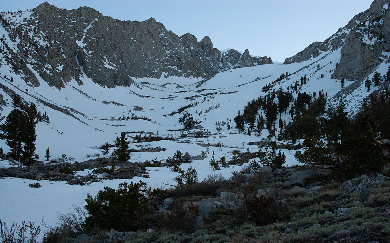
At six forty-eight p.m. my pack hits the ground. I've made it to the sage-choked flats at the bottom of the Bairs Creek Cirque. After climbing over 4000 total vertical feet, I've reached camp.
I'm guessing—more like hoping—my current elevation is around 9500', meaning I'm only 5000 vertical feet below the summit. You know...thinking about numbers like that isn't going to do me one bit of good. While climbing solo generally agrees with me, camping solo is another matter. The loneliness of this place instantly presses against me.
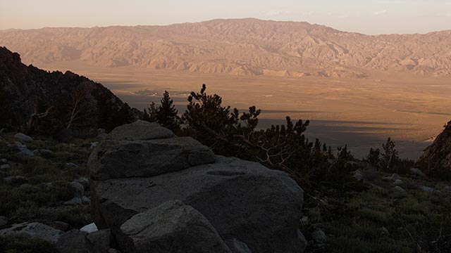
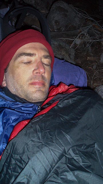
It's cold. A stiff breeze is blowing. I hold off putting on additional layers so my clothes can dry. To stay warm, I stagger about on wasted legs, surveying the area for a good place to camp.
The tiny town of Independence is clearly visible a vertical mile or so below in Owens Valley.
I'm too tired to do much walking, so I pick a small hollow near a boulder, flatten the ground a bit, and call it home. Since I'm out of water and dehydrated, the first priority is melting snow. Luckily, there's a nice patch of snow right near camp. I set up the stove and soon have a pot of water going.
It will be dark soon.
I brew a quick salty cup o' chicken soup and keep melting snow. For a full hour I just melt snow, drink water, melt more snow. I want to start the night with both my liter bottles and my belly full of water.
Dinner is a Mountain House Pro Pack meal, which I've found to be the tastiest, saltiest, and most nutritious of the freeze-dried fare. After I've eaten I feel better, and it's time to hit the sack—literally.
To save weight, I'm traveling very light. I don't have a change of clothes, and what I've got is barely enough to keep me warm while I'm moving.
I've left behind my shovel and probe, and I'm not carrying a tent. Instead of my usual winter sleeping bag and tent, I've got a 40° Marmot Atom (weight: one pound even) plus a bivy sack. That may sound Spartan, but I don't intend to do much sleeping tonight. My ambitious plan is to rise at 2 a.m. and start skinning up the cirque.
Wrapped up in my bivy and sleeping bags, I'm surprisingly warm and comfortable. It's been a while since I've slept beneath the stars. Doing so now awakens fond memories of camping in Arizona's canyons with family and friends. With a bright, cheery moon above and the constant tang of sage wafting about, I reflect on how lucky I am to have had such fine experiences in wilderness.
And so, now there is little to do but wait, try to grab as much sleep as possible in the thin mountain air. The breeze remains cold and gusty. I cinch my sleeping bag a little tighter, watching the stars for meteors. The lights of Independence glow in the distance, a comforting human presence for the weary solo traveler. I close my eyes.
Time passes slowly in the mountains, especially at night. I shift fitfully. The moon creeps across the sky. Occasionally, I check my clock, wondering if it's time to get up and resume the climb. I startle awake again, this time to darkness. I'd been hoping the moon would stay high enough to enable me to see during my night climb, but now the moon has gone behind the walls of the cirque.
In contrast to my earlier optimism, my mood has darkened as well. My body isn't doing much better. My back hurts. One of my feet is going numb. And half my face is tingling. My heart rate seems too high. I consider abandoning the climb, sleeping till dawn, and then getting the hell out of here. Do I really want to climb any higher on this merciless mountain?
I remind myself that I knew this was going to be hard. I knew I would have to battle dark moments. I knew I would be tested, pushed to my limits. And somehow, against every impulse commanding otherwise, when 2 a.m. rolls around I unzip my sleeping bag and crawl out into the night.
Skinning in the Dark
Darkness. I scramble from my campsite down the steep, rocky edge of a ravine to reach the snow. In my ski boots, this is an awkward task, not helped much by the feeble light of my tiny headlamp.
Once I reach the snow, I snap into my skis and turn off the light. As my eyes adjust, I can see the vertical walls of the Cirque rising against the stars. The snow is a dim blob stretching out to infinity before me. I take my first slow strides upward.
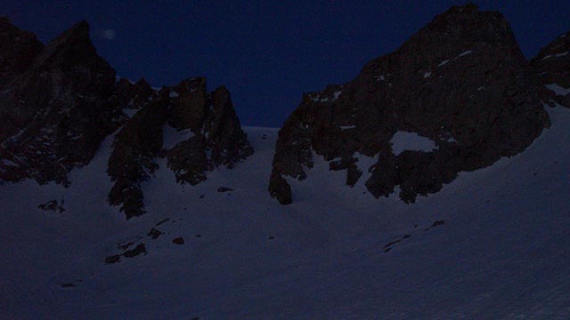

Thanks to this extremely early start, time should be on my side. All I have to do is keep skinning up, and I'll reach the summit. Or so I tell myself.
My body is still feeling the effects of the previous days' climb. And skinning in the dark has its own complications.
I can't see nor sense the angle of the snow. As the Cirque gradually steepens, my climbing skins begin to lose their grip on the frozen snow.
Ski crampons would help, but I don't have them, so I must pop out of my bindings and walk upward, skis in hand.
In this manner, switching back and forth as necessary, I make my way upward through the night. My pace seems pitifully slow, and after what feels like an hour of climbing, I doubt I've gained much ground at all. The wind pushes against me, blowing downhill. I'm trying to stay in my skis as much as possible, resorting to sidestepping rather than boot hiking, inching my way up the mountain.
Time drags on meaninglessly, seconds, minutes, hours, as if I'm in a giant sensory deprivation experiment. The moon is completely gone now. Blackness surrounds me. To my right is a towering spire of rock, visible as a looming outline in the darkness. I recognize this feature: what looks like a full-fledged mountain is actually just a minor bump along one of Williamson's endless ridges. The fact that this spire still dwarfs me means I've got a long, long way to go. Something inside me snaps: You Lied! my mind screams.
You said if I could reach the snow, I could ski this mountain, but I can't it's impossible impossible this mountain never ends.
I struggle to come to grips with myself. I try to remind myself that I knew these feelings would come, that I was ready for them, but here in this Heart of Darkness, climbing up an infinite slope, I have no more defenses to offer. I have been tested, and found wanting. Despite all my pride and preparation, Williamson has beaten me. I can't go on.
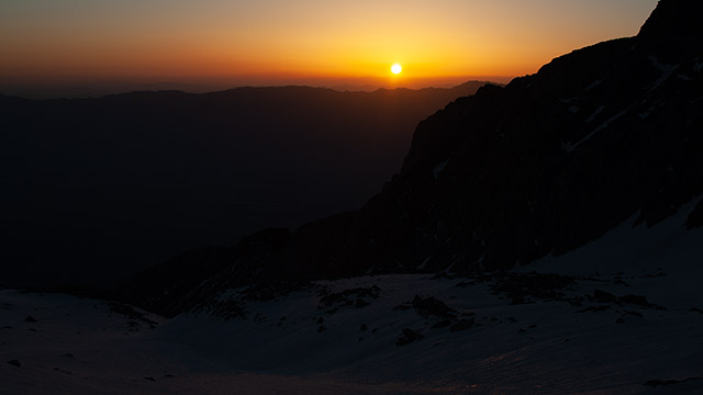
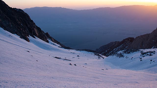
Deliverance comes unexpectedly then, rescuing me from this total despair: from the east begins the first faint glow of the coming dawn. Even just this tiny hint of light is enough to show me that I am actually near the headwall of the Cirque, elevation 12,000 feet. The angle of the upper Cirque lessens, and this, along with the added visibility, lets me skin upward with relative ease, picking up the pace.
Every passing minute brings more light to the sky, and more cheer to my heart. My crisis of spirit passes, and I am once again able to believe success is possible. I had hoped to reach the headwall at dawn, and here I am, on-schedule. If I wasn't so tired, overwhelmed from my confrontation with personal demons, I'd be elated. Instead, I just focus on breathing, taking a step, another breath, another step. There is still a long way to go.
Headwall at Dawn
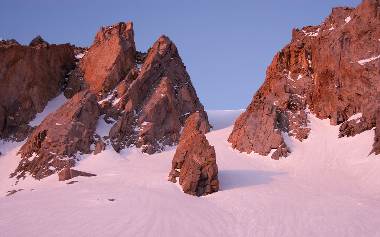
Granite spires come alive as the first rays of dawn touch them. I skin as high as I can up the headwall, then stop on a small flat perch and switch over to crampons.
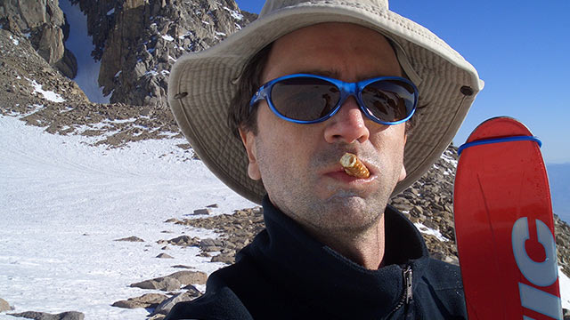
As the new day rises, chasing away the lingering shadows of my despair, I eat a peanut butter sandwich, drink water, and enjoy the view. For all its challenges, hiking through the night has paid off. At 12,000', I'm well-positioned to make an early summit before the snow becomes too soft.

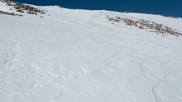
The only challenge between me and the summit now is fatigue—and about 2500 vertical feet. With the appearance of the sun, the day warms with alarming speed.
I pull off my fleece cap and windshirt, and begin ascending the short pitch of the headwall chute.
I can't help stopping, from time to time, to enjoy the view.
After all, this is the first time I'm seeing any of the Upper Cirque, having climbed this far in darkness.
The frequent stops are also necessary to catch my breath. Coming from sea level, I've about reached the altitude where my body slows down considerably.
It's a struggle to make upward progress in the thin air. Nothing about this hike, it seems, is going to be easy.
On the other hand, my crampons are biting nicely into the hard, consolidated snow.
This is a huge contrast from my recent climb up Langley, when I sank deep into the snow with each step, and the mush continually stuck to the soles of my feet, rendering crampons nearly useless.
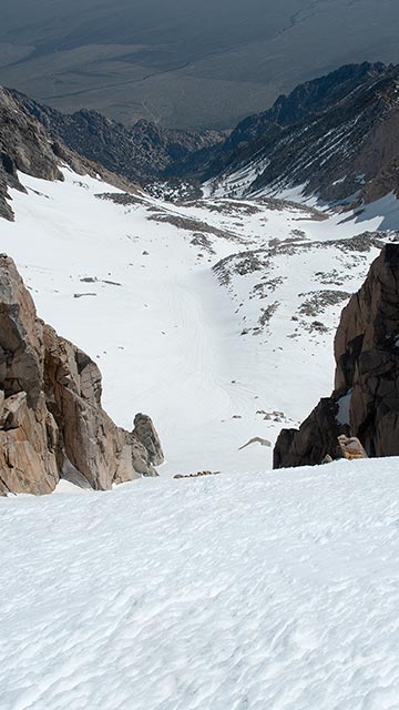
I aim for the pillar at the center of the upper apron, staying in the shade to keep the heat of the sun off my neck. The angle of the Bairs Creek Headwall is just steep enough to be lively, without any significant danger.
An experienced ax man should have no trouble arresting a fall here, and even if that fails, there's little below to pose much threat.
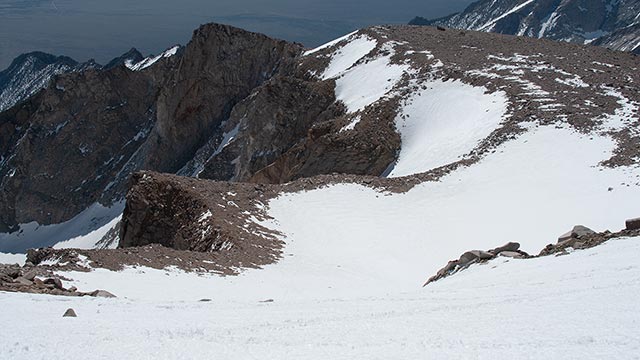
Given the huge effort I've expended to get here, I'm well glad not to be facing much objective hazard. As for skiing, the Headwall promises a fine descent. I estimate the angle around 35°. To the left, the pitch steepens, perhaps nearing 45° for a short section.
The right side remains moderate all the way to the top of the Cirque.
I reach the top of the pillar.
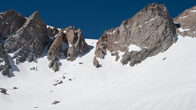
The geology here is reminiscent of volcanic action: a series of angled pillars that close around the top of the Cirque like teeth.
Williamson's granite is surprisingly colorful here; beautiful.
As I ascend the upper pitch of the Headwall Couloir, I notice for the first time the unmistakable tracks of a pair of skiers or snowboarders, probably less than a week old. So, I think, someone out there is as crazy as I am. I offer a salute of backcountry solidarity to my unknown predecessors, and go back to the climbing.
Oh, so close! I am nearing the top of the headwall, elevation 13,000'. I hope to get my first glimpse of Williamson's summit. The sight of it should provide the mental kick I'll need to keep going. Just show me the summit, I think, as I at last top out the headwall.
That view, alas, is not to be. I push myself up the last few steep steps at the top of the couloir, only to see yet another giant headwall in my path.
I'm in a vast bowl, with tantalizing views of the George Creek drainage to the south, and Williamson's twin 14,000' horns to the northeast. From here, I've still got another 1400 vertical feet or so to climb, the final push in what can only be called a marathon test of endurance.
The temperature continues to rise, motivating me to keep moving.
I had hoped to ascend the remainder of the way on skins, but the upper headwall is clearly too steep to allow that.
The angle looks moderate enough, however, so I drop my axe and crampons and stash them along a rocky spine at the top of the Cirque to save weight for the summit push. I'm intrigued by the horns, and especially the narrow, southeast-facing couloir that splits them. Most guidebooks warn that this chute avalanches regularly. Looking at it, I'd guess the danger is principally from wet slides.
Another concern, for those who'd like to ski it, is the lack of summit access. From the notch between the two peaklets, Class 4 climbing is required to rejoin Williamson's summit plateau. I skin up across the bowl, slowly gaining elevation, until the angle of the upper headwall becomes too steep to continue. Once again, it's back to boot hiking. As the altitude continues to drain my reserves, I decide this is the real Heartbreak Ridge.
The views continue to amaze. I'm well above the entrance to the Bairs Creek Cirque now. Unfortunately, the jagged tops of Williamson's twin horns remain well above me. The horns serve as a mental marker. I keep checking over at them, wanting to see how much higher I have to climb.
It takes me a solid hour to finally round the top of the upper headwall, and stand upon Williamson's summit plateau. The true summit appears as a distant hump at the western edge of the plateau. Just another quarter mile to go, maybe a few hundred vertical feet. The warmth and calm of the mountain's lower slopes are abruptly replaced with a frigid, blasting wind.
The snow shifts from consolidated spring corn to winter wind slab. I'm able to resume climbing on skis and skins, thanks to the reduced angle, but this final pitch is a killer. I want so much to be done with this climb. It has taken everything I have to give, and more—and I've still got to face that hellish hike out once the descent is done.
I cinch my windshirt's hood tight and clench my frozen fingers against my palms. This is it. The summit is only a half hour or so away. Just keep climbing, keep climbing, keep climbing...it'll all be over soon. I promise.
Williamson Summit
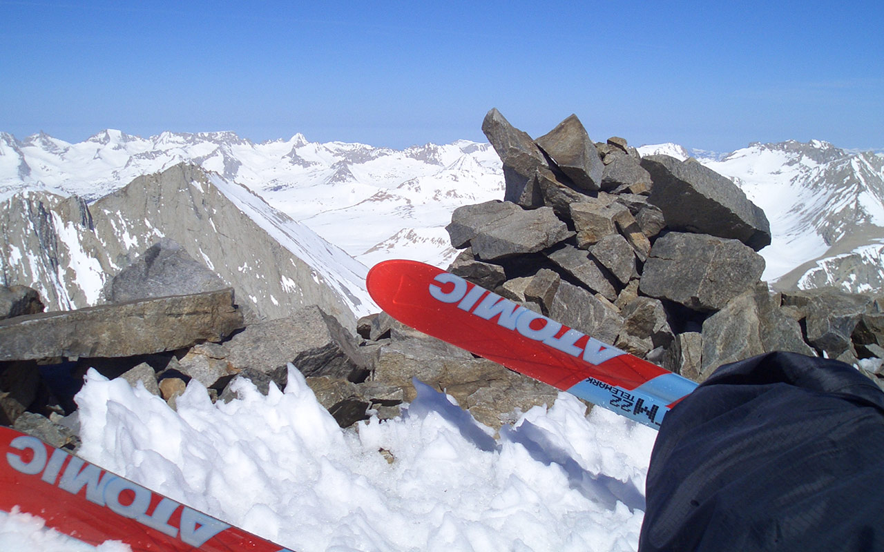
Ordinarily I feel elated when I reach the summit of a big peak—especially when I've got skis on my feet and I know I'm about to ski the mountain. As I take my final steps to touch the summit cairn atop Mount Williamson, however, I'm physically and mentally exhausted.
I want only to get this over with, get down to a warm, safe, low place and start nursing my wounds.
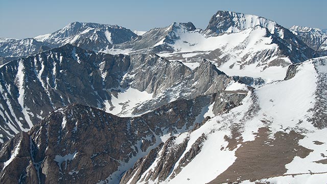
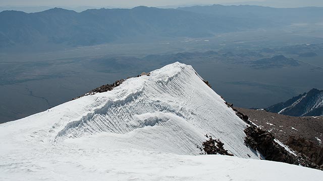
I take a quick photo of the summit cairn, my skis, and Mount Tyndall in the background. In every direction are stunning views, but I'm just too tired to care. I open my desperation food, to be used only in times of emergency: Peanut M&M's.
The extra energy is sorely needed.
Yes, indeed, I will ski this big fourteener from the very summit today, thanks to a narrow patch of snow extending along the summit ridge's southeast aspect to the wind-swept summit plateau.
I begin my descent at 9:30 a.m., right on schedule.
The snow is hard but serviceable beneath my edges. It feels so good to be sliding down instead of crawling up. As I'm descending, I realize the view toward Owens Valley is stunning.
Because Mount Williamson rises east of the Sierra's crest, I feel as if I'm hanging over Owens Valley. The massive 11,000+' vertical relief is wholly evident.
Looking south, I have fine views of Mount Langley, Mount Whitney, and Williamson's George Creek drainage.
Seen from the top of Williamson, Mount Whitney looks every bit the Sierra's highest mountain, presenting a dramatic north face that includes the upper portion of John Muir's Mountaineer's Route.
Returning to the business of skiing, I put my camera away and descend Williamson's upper windblown slopes. I want to get down this mountain, down to air I can breathe. The skiing is surprisingly good.
As I drop onto the steep pitch of the upper headwall, the summit plateau's winter snow gives way to spring corn, which flows effortlessly beneath my edges.
I push the pace, letting the wind blow through my hair, carving turn after turn, loving my sudden ability to move at will across the mountain. With surprising speed, I'm back at the top of the Bairs Creek Cirque, retrieving my crampons and axe.
I drink some water as I survey the massive Cirque. Much of it I still haven't seen, due to my ascent in darkness, so I'm eager to explore this vast playground of ski terrain.
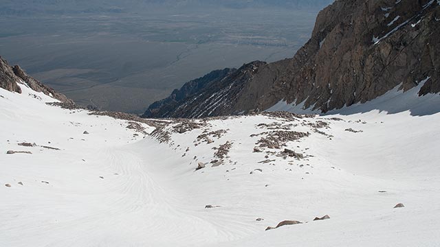
From the top of the Couloir, I can see all the way down the Cirque to the flats where I camped, as well as Heartbreak ridge beyond, the Hero's Traverse beyond that, the cursed Notch, still farther, Foothill Road.
I'd enjoy that view a whole lot more if I didn't have to descend all of it in the next few hours.
Skiing the Headwall Couloir turns out to be good, clean fun. The moderate angle (let's call it in-bounds expert) and the perfect corn snow makes for the best skiing of the tour.
The view's not too shabby, either. Though from Highway 395 the cirque appears largely flat and featureless, in reality, it is divided by three large ridges or benches.
From the top of the Upper Bench, the snow seems to hang out over the Owens Valley, like a vanishing-edge swimming pool. It's a fine illusion. Now that I'm able to see the Bairs Creek Cirque in daylight, it looks smaller than I expected, more contained within its sheer granite walls.
The drainage makes a series of sweeping 'S' turns, which I follow, riding whichever side has the better snow. I'm trying to assess this descent as I ski it. I myself have written that it ranks among the Sierra's best. Do I still feel the same way? After the unmitigated Hell of the approach, part of me feels the descent doesn't offer enough reward to justify the effort.
It is a telling indicator that I'm thinking about that Approach even now, when I should be enjoying skiing this vast, sweeping Cirque. Part of the problem may be the way the route back home is staring me in the face the whole time—a potent reminder of things to come. Still, I've never experienced a summit descent from a Fourteener like this one.
In contrast to Langley's massive Northeast Couloir, Williamson's Bairs Creek Cirque and summit plateau make for a very different experience. The variety of scenery and terrain, and the effort required to traverse it, make this descent stand out even among giants. The problem comes when you consider this massive route and mountain only from a skier's point of view.
Skiers like roads, chairlifts, hot tubs, and warm beds. Anyone seeking the usual ski experience in Mount Williamson's Bairs Creek Cirque will be severely disappointed. This is a ski mountaineer's peak, as Paul Richins Jr. calls it, a place where skiing is only a distant part of the equation. If that formula works for you, you'll find no Sierra descent to equal it.
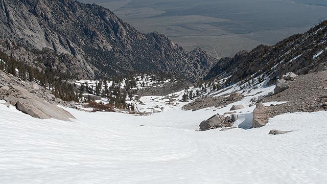
I make a quick stop at camp to collect my overnight gear. Still on skis, I wind my way down the narrowing ravine at the base of the Cirque, trying to stay on snow as far as possible. After perhaps 500 vertical feet, I reach the waterfall pinch, the end of the line. It's time to trade skis for hiking boots, and face once again the miseries that await below.
Once is Enough
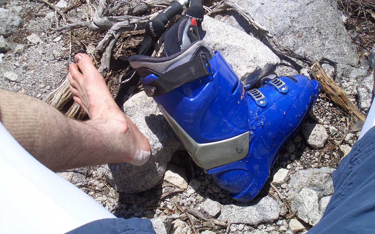
From skis to hiking boots I go. Mentally, this is another low point. I can scarcely imagine putting that heavy pack on again, much less repeating the rigors of the Williamson Approach in reverse.
Perhaps the only salvation is knowing it's all downhill from here. Except, of course, for the climb from the creek to the Notch. I dry out my feet and tape up anything that looks like a hot spot. Speaking of heat, the day is a warm one, probably near 70 degrees.
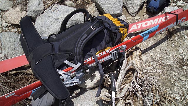
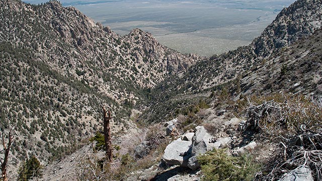
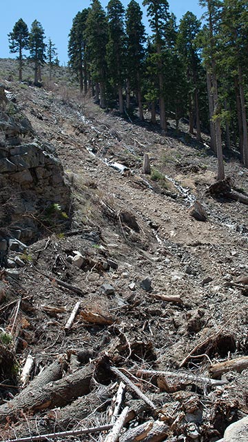
It's 11 a.m. I'm already regretting my plan to hike out today, rather than spend an extra night. I stuff everything, boots included, into my backpack, cinch it up, and strap on the skis.
I stare at the fully-loaded pack, squinting in the sun, regarding it as an abomination. Can't we just skip this part?
My pack has been a disappointment on this hike. The waist belt's design makes a poor fit for my narrow anatomy, consequently my shoulders have been bearing too much weight.
To get around the waterfall-pinch, I've got to traverse westward, up the ravine's ridgeline. These first few steps are truly special: back to hiking on that loose, scrubby talus.
I warn myself to stay focused. Hiking down such loose, steep ground with no trail is dangerous. I make considerable use of my ski poles, trying to transfer as much weight off my feet as possible with each jarring step down.
The top of the ridge provides a smashing view of the route ahead. I elect to keep traversing westward, descending the steep, loose scree and avalanche debris alongside the World's Luckiest Forest.
The violence done to this region is sobering.
Shredded trees and debris liter the ground, which has been scoured down to bare earth. I slide down the loose scree, making good progress toward the creek below.
Bairs Creek, of course, is utterly choked with avalanche debris. I am astonished to see mature trees exceeding 10 feet in diameter among the carnage. The size of these victims leads me to believe the perpetrating avalanche was a hundred-year event. I carefully make my way across the piles of debris, to the creek's north side, and the start of the long traverse to the Notch.
The scale of the slide defies description.
This is the same avalanche, remember, that created the giant snow bridge and cave some 500 yards east of here.
The aching in my shoulders has become a constant companion. I take a moment to pull my pack up, try to cinch that damned waistbelt tighter. I'm sweating in the heat. It looks like I'll run out of water around the Notch, but that's okay, I've got a liter waiting for me at the car. I'm so ready to be done with this hike.
On to the traverse.
I try to maintain a higher line toward the Notch, thinking I see the semblance of an upper traverse path. It's a mistake. I get hung up above a nasty series of bluffs and have to downclimb a good two or three hundred vertical feet.
There's just no easy way to do this route.
I make the Notch about an hour and a half later, where I do indeed drink the last of my water.
I take a last look at the magnificent Cirque and Headwall Couloir, trying to see my tracks. Ah, misery. I'm close now, just another 1300 vertical feet to go. The traverse from the Notch to the ridgeline above Bairs Creek is long and tedious. Everything is long and tedious now. I'm starting to go crazy thinking about that water in my car. Time seems to tick along at a snail's pace. Just keep going, keep going. Try to lift that heavy pack off my shoulders, which are screaming in protest now.
I can see the car, a dot in the distance. When I do finally reach it, another hour later, I'm too exhausted to even stand. I slide my pack off my shoulders. They're so worked I can't lift my arms. For a few minutes I just sit there on the ground, staring dumbly at my car, hyperventilating, trying to summon up the will to stand and get at the water inside.
I've traveled a staggering 18,000 vertical feet in 24 hours, give or take. I try to process these numbers, compare them to other hikes I've done, put them in perspective. I feel none of the usual euphoria after a big climb. Just relief. Later, perhaps, when I've drank and eaten and slept and rested, I'll be able to begin to appreciate this hike, I'll begin to be able to see it as the remarkable personal achievement it is, a once-in-a-lifetime experience. For now, however, I just want to go home.
And with that thought, I put my gear in the trunk and start my car.